
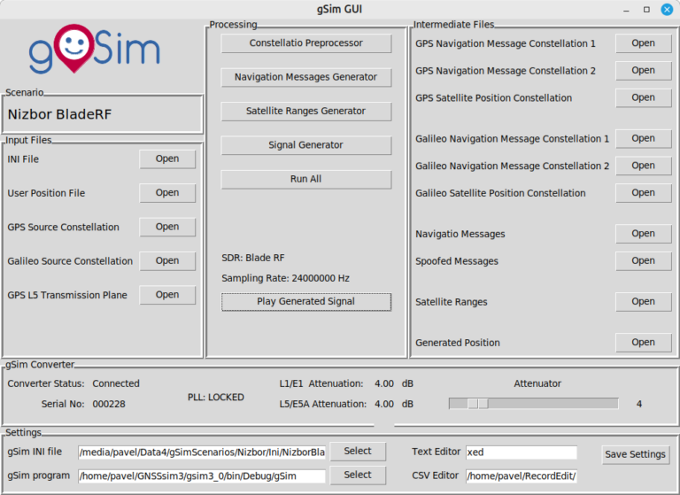
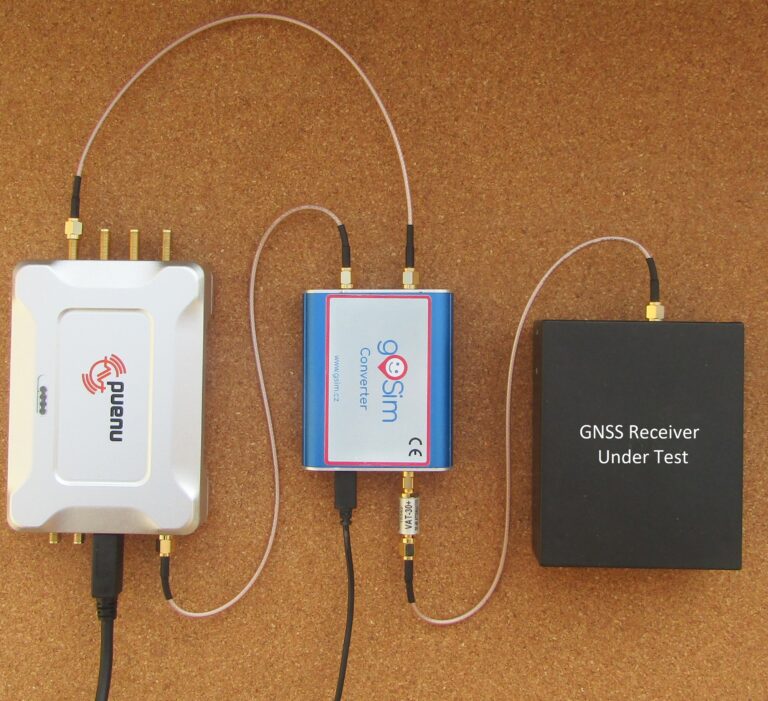

gSim uses commercial, cost-effective SDR receivers augmented by gSim Converter for signal generation. It enables the generation of perfectly synchronized and coherent signals on L1/E1 and L5/E5A frequencies.
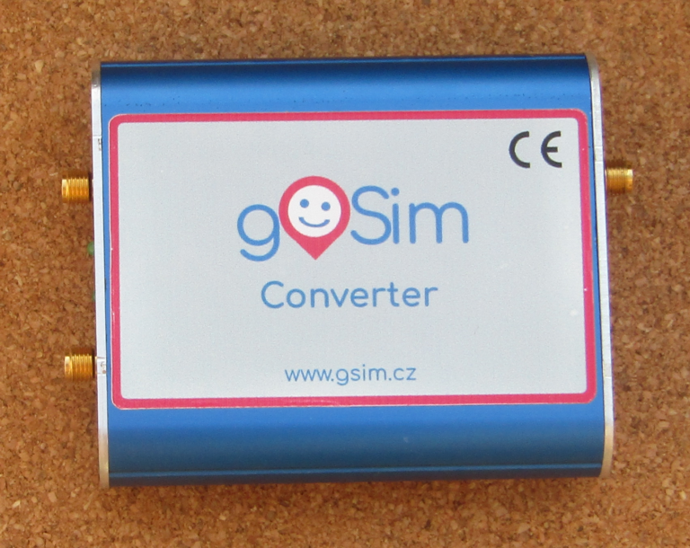
gSim Converter can regulate signal levels within a range of 31 dB. A further increase of 30 dB is achieved by removing the attenuator.
The timing of the navigation signals and all carrier frequencies are derived from the frequency standard of the SDR transceiver. In case of higher requirements for accuracy and frequency stability, an external frequency standard can be used.
Single-frequency measurements can be performed without the gSim Converor. The signal generated by the SDR must be attenuated using an external attenuator.
The gSim converter integrates the software licensing dongle required for commercial and space gSim licenses. The gSim converter must be connected to the computer during gSim software operation.
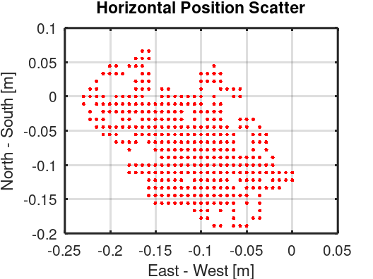
Nizbor is a village located on the banks of the beautiful Berounka River in central Bohemia. Within the village, there is a Celtic oppidum, and a castle is situated on a nearby hill. Adjacent to the castle, we have a waypoint with magical coordinates 50°N,14°E, which we call Nizbor.
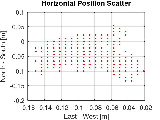
The figures present the scatter plots of static user scenarios in Nizbor way point measured by a dual-frequency GPS – Galileo receiver. The signal was replayed by a BladeRF (left) and HackRF (right) SDR.
3D scatter plots, static position errors, as well as other static and dynamic simulation scenarios, are introduced in gSim Simulation Guide.
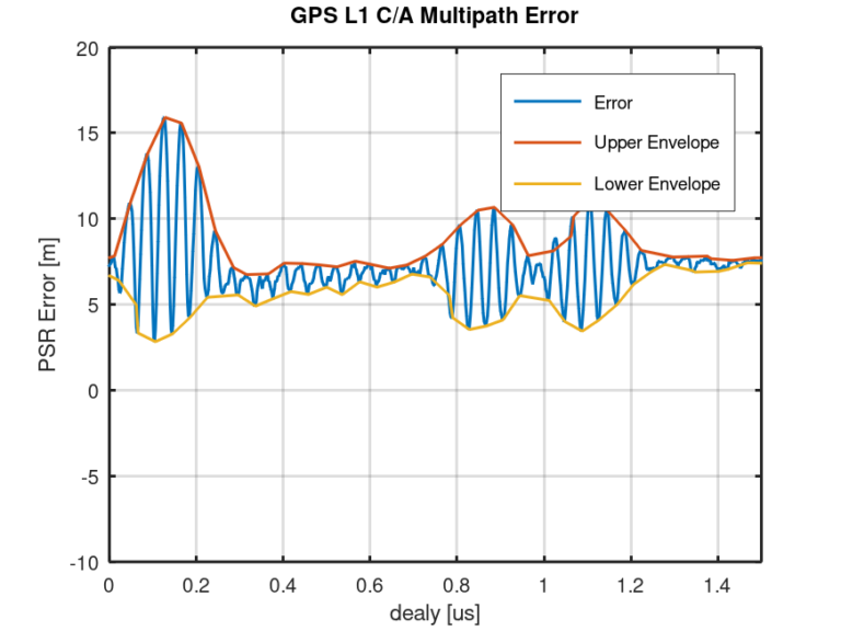
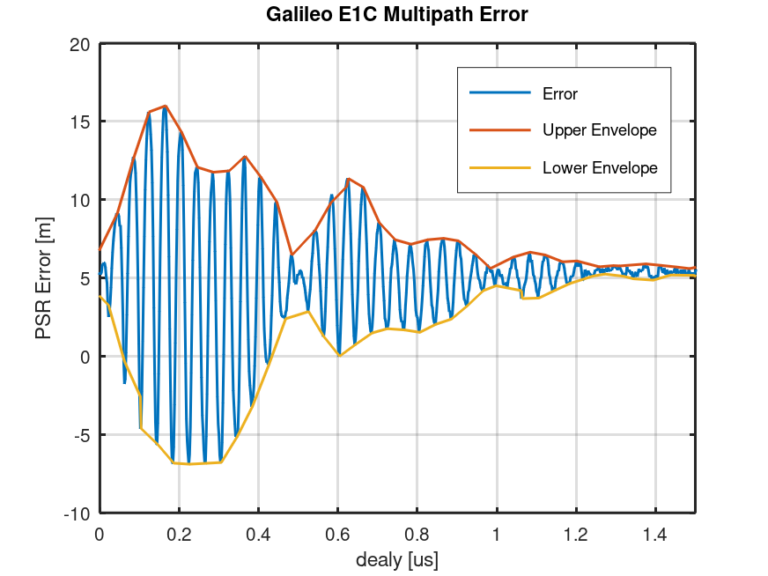
Multipath propagation is one of the main sources of position errors in GNSS. The receiver’s capability to suppress multipath propagation is measured using a signal model with a Line of Sight (LOS) and one delayed reflected signal. The results are graphically expressed as a multipath error envelope plot. The left figure presents a multipath error envelope of the GPS L1 channel equipped with a double delta correlator. The right figure shows the multipath error envelope of the Galileo E1 channel.
Presented Multipath Error Envelopes were measured by gSim using a reflected signal generator.
Adding or removing leap seconds to UTC is used to correct UTC to astronomical time. gSim allows testing the response of a GNSS receiver to a leap-second event.
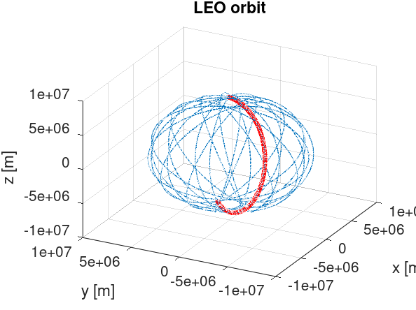
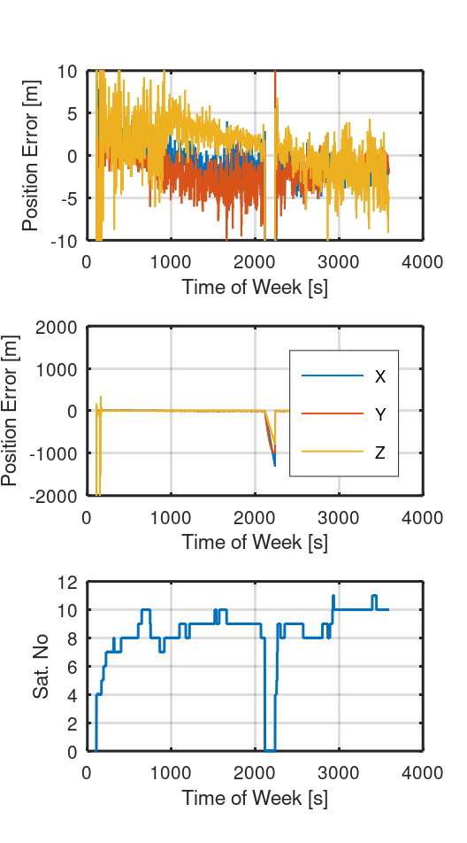
gSim can test space GNSS receivers. The figure presents the test results of the piNav GPS receiver in Low Earth Orbit. The piNav GPS receiver was developed by Pavel Kovar for positioning the LEO CubeSats. The receiver is equipped with an orbit propagator that enables Dead Reckoning navigation when the GPS signal is out.
Notice a short simulated signal dropout at time 2100 s. The outage of the GPS signal was bridged with the help of the propagator.